VolksNav in Cameroon, starting with urban radius r100
Click a red or green circle to discover the national city code of the clicked area.
The blue area on sector m1 shows a quad 100 km x 100 km. The bended sides "point" to the national pole CM r0.
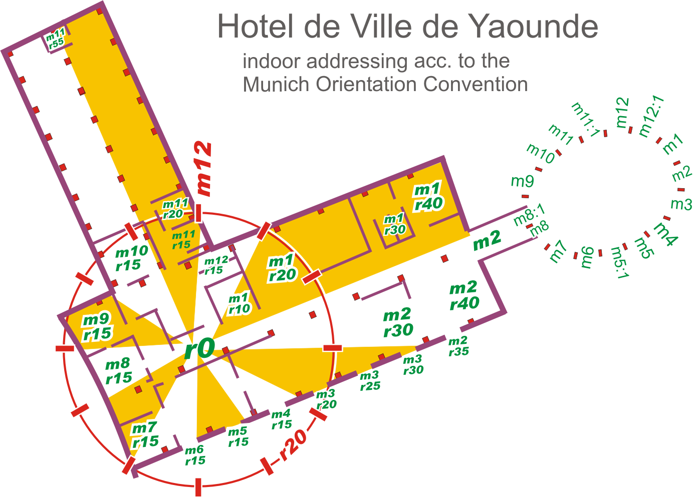
The definition of the radius r100 allows to build national, urban and indoor location codes based on imaginary clocks which are smarter than room numbers, post codes or other alternatives. They look like this urban example:
| StatusQuo Yaounde m4:7 r22 |
This target could be a building, a crossing, a stop point, a bridge etc. within Yaounde. The conventions for this format with hours, minutes and radius are as follows:
| element | meaning | details |
|---|---|---|
| StatusQuo | prefix of an urban position code | Bases on an relevant point called r0, the urban pole. Example Yaounde: place A. Ahidjo |
| m12 | reference horizon hour |
from urban pole to north, m3 to sunrise, m6 to south etc. These direction lines divide the city like a cake into 12 m-sectors. |
| number after ":", e.g. m12:5 | horizon minutes, blue lines |
distance to horizon hour,
|
r..., e. g. r66 |
radius, red lines |
distance to urban pole, 1 unity = 100m. |
For more datails, see: Urban systems:
Yaounde CM r0 - Douala CM m9:20 r200 - Bafoussam CM m10:98 r218 - Bamenda CM m10:130 r278 - Buea CM m9:33 r255 - Ebolowa CM m6:40 r111 - Garoua CM m12:210 r640 - Kousseri CM m12:390 r994 - Kribi CM m8:12 r205 - Maroua CM m12:315 r81 - Mt.Cameroon CM m9:42 r263 -
more cities: see right hand
---------------------
| National Codes, free | https://volksnav.de/Cameroon/NationalCodesFree |
| Download free Windows converter | https://volksnav.de/converterCameroonFree.exe or https://volksnav.de/CameroonConverterFree.txt (rename to .exe) |
download KML files for National Codes |
circles | hours | minutes |
Street signage:
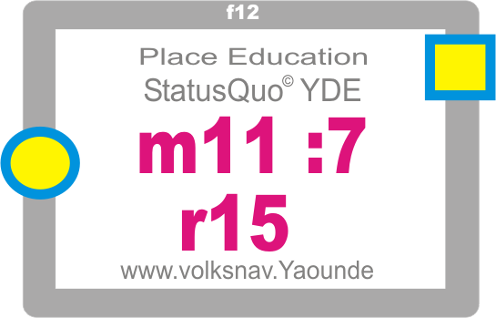 |
This place is on sector YDE m11, Distance to m11-direction: 7 x 100m . Distance to center of town: 15 x 100m, Center of town is in direction f9/left hand North is in direction f2 |
-------------
Version with advertisement (lollippp)
 |
Crossing code m9:5 r23, north is right hand (red), downtown is behind (yellow/blue) ------------------ |
Modern house number with 8 benefits:
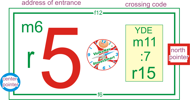 |
Crossing YDE m11:7 r15 is right hand This sign is situated 5m from the crossing in direction m6/south. Center of town is in direction f8 North is in direction f3 |
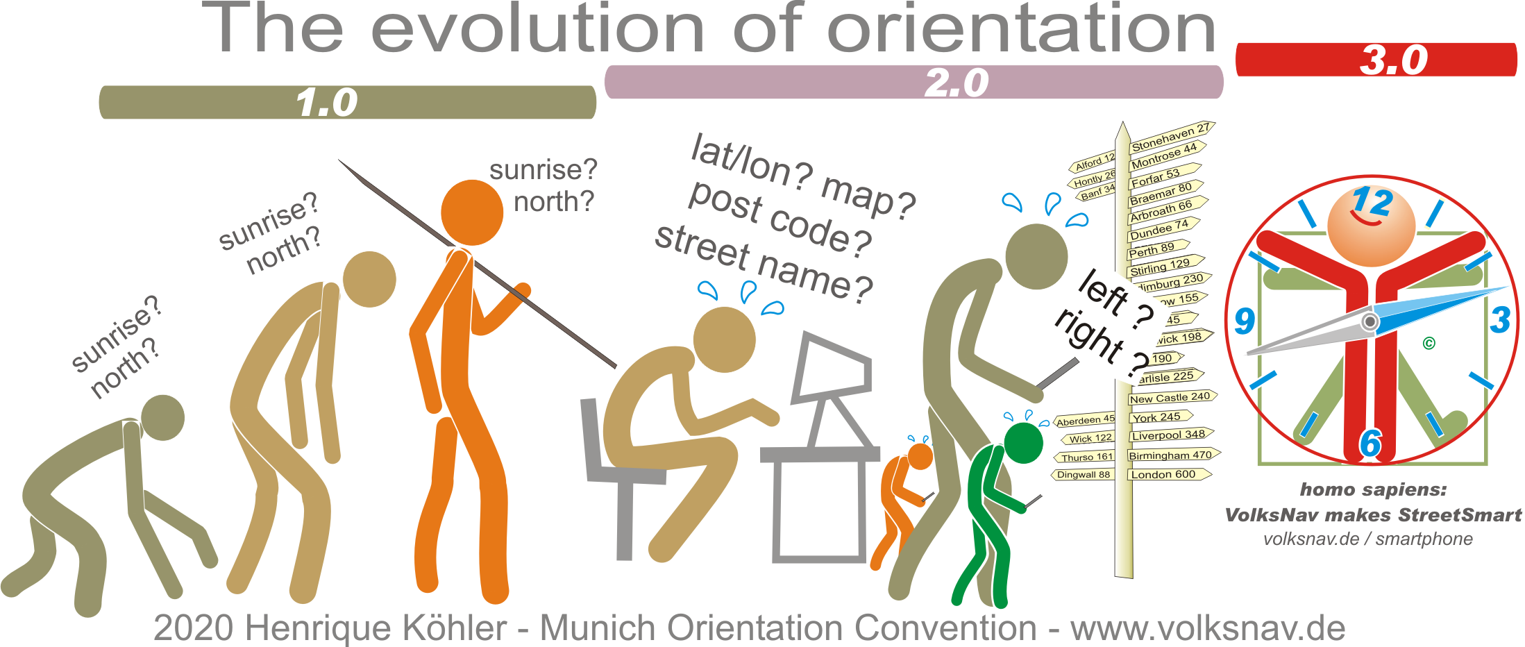
Evolution: